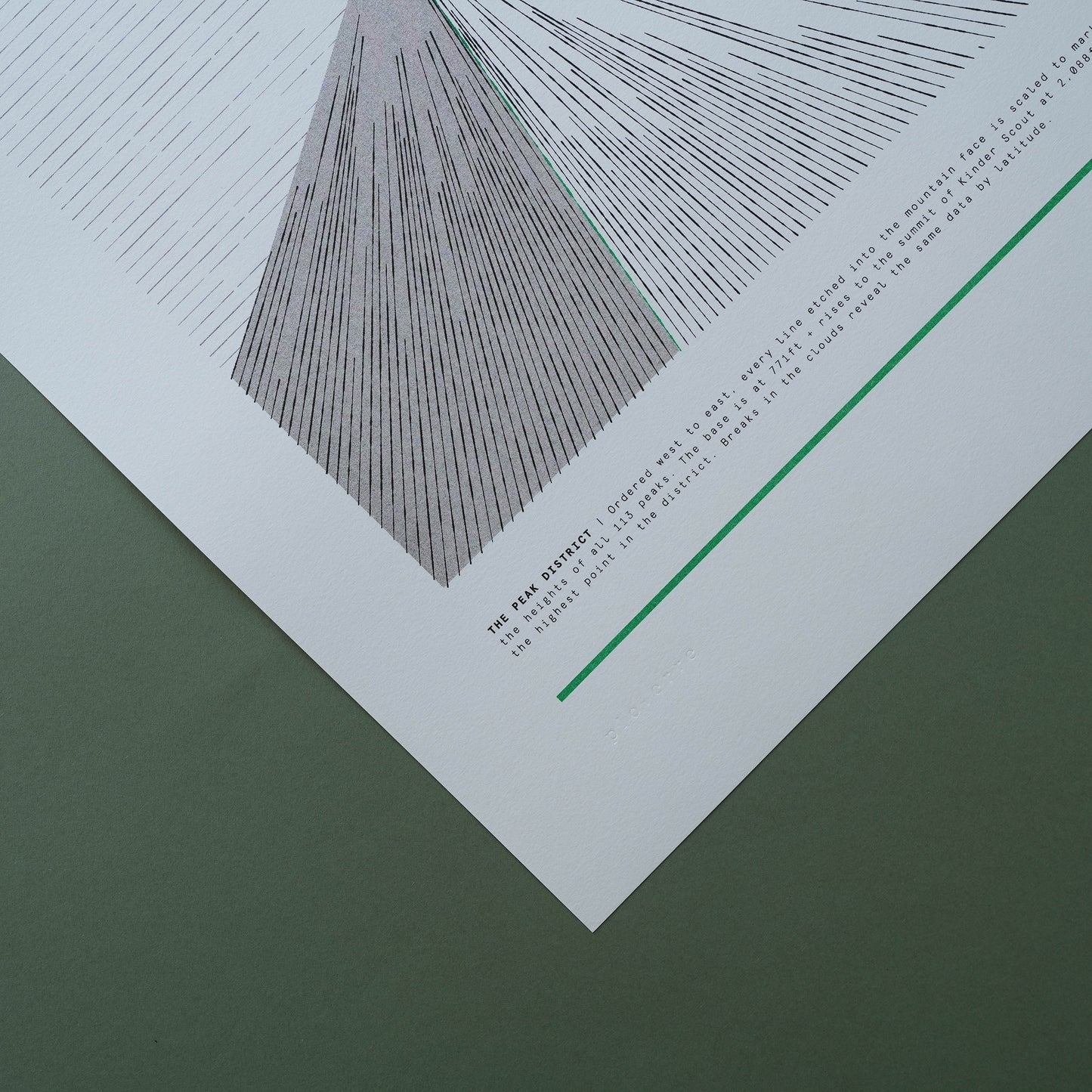
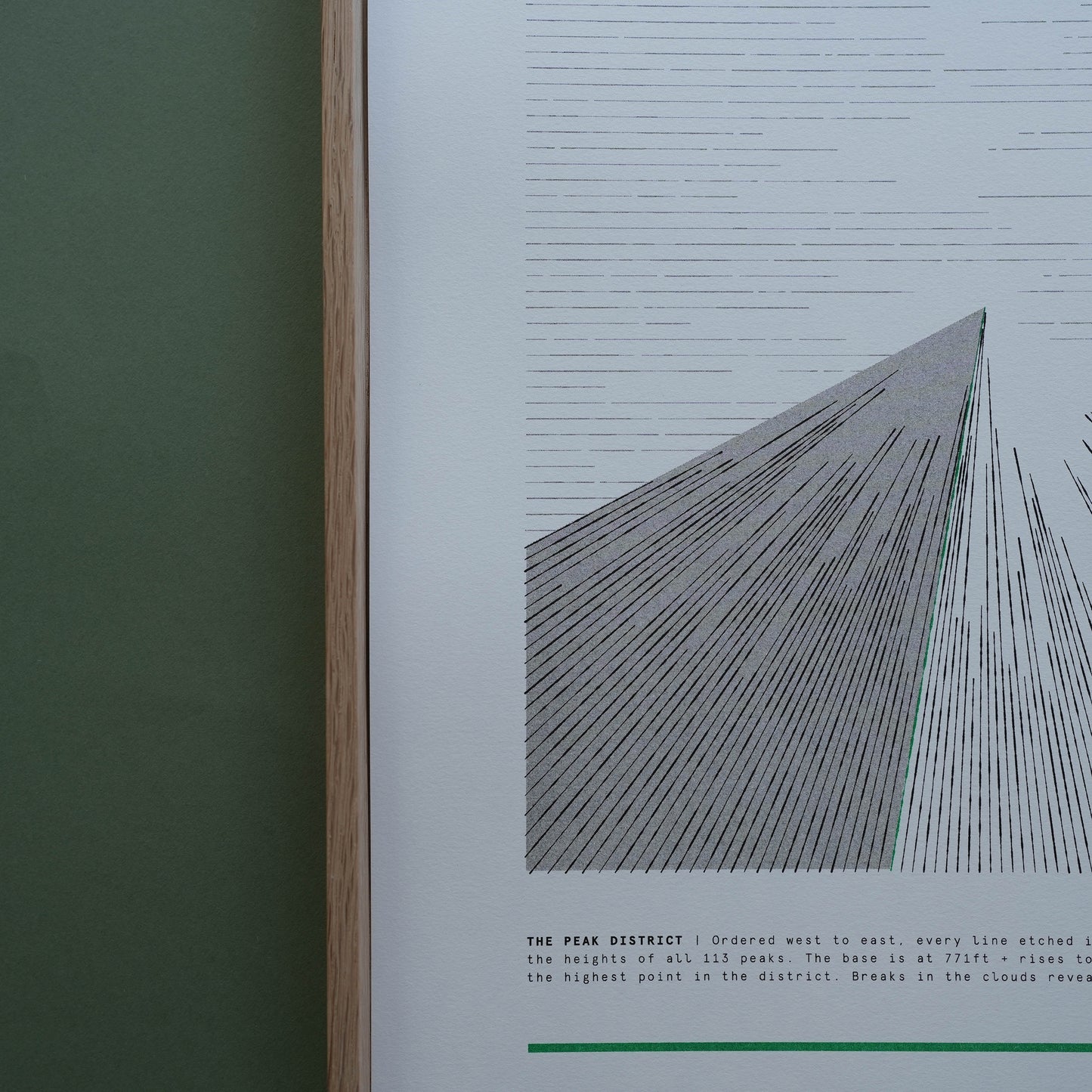
Mapping the summit data of all 113 mountains within the Peak District National Park.
Using data from every summit within the Peak District, each line represents the height of an individual mountain. Ordered west to east (left to right), the longer the line, the taller the mountain.
The shading represents the point of the highest peak within the range and each of the four mountains are drawn to the same scale so the overall height can be compared across the series.
Specifications
297mm W x 420mm H (A3) Limited Edition Print (113) Risograph print